What Is a GIS Analyst & How Can You Become One?

Are you fascinated by the power of maps and intrigued by how data can reveal hidden patterns in the world around us? Do you dream of using technology to solve complex problems and drive informed decision-making? If so, a career as a Geographic Information Systems (GIS) Analyst might be your perfect match. This guide will walk you through what a GIS Analyst does, where they work, and how you can become one—with insights from industry experts Matthew DiBona and Madison Cox, adjunct instructors in Geography & GIS at the University of Cincinnati (UC).
Key Takeaways
-
- GIS Analysts transform spatial data into actionable insights, helping industries like urban planning, environmental conservation, and logistics make data-driven decisions.
- The demand for GIS professionals is growing rapidly, with a projected 13.1% job growth over the next decade, competitive salaries, and diverse career opportunities.
- Becoming a GIS Analyst requires a mix of education, technical skills, and hands-on experience, including proficiency in GIS software (ArcGIS), programming (Python/SQL), and data analysis.
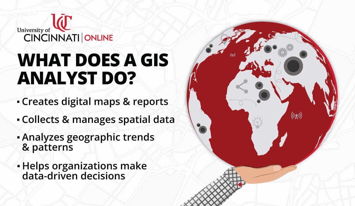
What Is a Geographic Information Systems (GIS) Analyst?
Think of a GIS Analyst as a modern-day cartographer with a digital edge. They specialize in collecting, analyzing, and interpreting spatial data to create digital maps and reports that inform decisions across various sectors. “GIS is the art of communicating complex information in a way that makes it accessible and understandable to the public,” explains Matthew DiBona, UC adjunct instructor and GIS Analyst. “Our maps are pictures that are worth a thousand words.” Whether it’s tracking environmental changes, optimizing delivery routes, or planning urban development, GIS Analysts turn data into actionable insights, making them indispensable in today’s data-driven world.
GIS Analyst Job Responsibilities and Overview
GIS Analysts work at the intersection of cartography, data analysis, and programming. A GIS Analyst’s responsibilities may vary by industry, but generally include:
- Data Acquisition and Management: Gathering data from GPS, satellite imagery, and databases, ensuring accuracy and consistency for reliable analysis.
- Data Analysis: Using GIS software to identify trends, patterns, and relationships through complex spatial queries and calculations.
- Map Creation and Presentation: Creating clear, informative maps and reports to effectively communicate findings to stakeholders.
- Problem-Solving and Decision Support: Applying expertise to address real-world challenges, such as planning city infrastructure or improving delivery logistics.
Madison Cox, UC adjunct instructor and GIS Analyst, highlights the importance of streamlining processes: “Building a model to perform tasks that once took an hour and reducing that to less than 10 minutes is immensely rewarding. GIS showcases how automation can transform workflows.”
Where GIS Analysts Work
GIS Analysts are highly adaptable professionals who apply their skills in a wide range of environments, blending technology with real-world applications. Their work isn't confined to a single type of setting. Some spend time in the field gathering data firsthand, while others focus on analyzing information from an office. The versatility of GIS extends across countless industries, from environmental conservation and government planning to healthcare and even retail logistics.
- In the Field: Collecting data directly using GPS devices, surveying land, or assessing environmental conditions.
- In the Office: Analyzing data, creating maps, and collaborating on projects.
- Across Industries: From government agencies to private corporations, GIS skills are needed in fields like urban planning, healthcare, and even grocery store logistics.
Cox encourages aspiring analysts to think broadly: “GIS jobs are everywhere—from hospitals to grocery stores. Don’t think narrowly when starting your job hunt. GIS is unironically everywhere, and the future will continue to be mapped by GIS Analysts!”
How to Become a GIS Analyst
Breaking into the GIS field requires a mix of education, technical skills, and practical experience. While many professionals start with a background in geographic or computer science, GIS careers welcome those from various disciplines who have an interest in spatial data and mapping technologies. Here's some more specific information about how you can become a geographic information systems analyst:
- Education: A Bachelor’s degree in Geography, Earth Science, Computer Science, or a related field is typically required. Advanced degrees, like UC's 100% online Master of Science in Geographic Information Systems, can open doors to leadership roles.
- Skills: Proficiency in GIS software (e.g., ESRI’s ArcGIS) is essential. Analytical thinking, problem-solving, and communication skills are highly valued, alongside familiarity with database management and programming.
- Certifications: While not mandatory, certifications like GIS Professional (GISP) demonstrate expertise and can boost your candidacy.
GIS Analyst Job Outlook and Trends
The demand for GIS Analysts is booming. Organizations are increasingly using GIS to optimize operations, improve decision-making, and address global challenges—like climate change, urbanization, and public health. This surge in adoption means that GIS professionals can expect strong job prospects and career stability in the years to come. Moreover, advancements in artificial intelligence, remote sensing, and cloud-based GIS platforms are transforming the field, offering new opportunities for innovation and specialization. In fact, a recent report from P&S Intelligence projects a 13.1% growth in this field over the next decade, much faster than the average for other professions. This surge is fueled by the growing need for spatial data analysis across industries like environmental services, government, and urban planning. As industries continue to embrace location-based insights, the role of GIS Analysts will become even more important in shaping policies, improving efficiencies, and solving complex challenges worldwide.
Why Choose a GIS Career?
“GIS offers the chance to make a real difference,” says DiBona. “Whether it’s protecting endangered species or improving access to electricity, GIS empowers you to tackle meaningful challenges.” This field offers a unique blend of technology, analytics, and creativity—allowing professionals to make a tangible impact in different industries. Plus, it doesn't hurt that GIS careers are actively growing and becoming more needed, which can give you more confidence in career stability and growth. If you enjoy solving real-world problems, working with data, and making an impact, this could be the perfect career for you.
Learn More About Becoming a GIS Analyst with UC Online
UC’s 100% online Master of Science in Geographic Information Systems program provides the technical expertise and practical experience you need to excel in this field. From spatial analysis to database design, our program equips you with in-demand skills to thrive as a GIS Analyst. “UC’s program ties coursework to real-life scenarios,” says Cox. “Students gain hands-on experience, preparing them for professional challenges with a solid foundation in GIS technologies and techniques.” Reach out today to discover how UC's flexible, online program can help you start your GIS career.
Frequently Asked Questions (FAQs)
What is the role of a GIS analyst?
A GIS Analyst collects, analyzes, and interprets geographic data to create digital maps and reports that support decision-making across various industries. They use specialized software to identify spatial patterns, optimize logistics, and solve real-world problems in fields like urban planning, environmental conservation, and public health. Their work helps businesses, governments, and organizations make data-driven decisions based on location-based insights.
Is a GIS analyst a good career?
Yes, a career as a GIS Analyst offers strong job growth, diverse opportunities, and the chance to make a meaningful impact. With GIS technology being used in everything from climate change research to transportation planning, demand for skilled professionals continues to rise. Plus, GIS careers offer a blend of technical skills, problem-solving, and creativity, making them both dynamic and rewarding.
How much does a GIS analyst earn in the U.S.?
The salary for GIS Analysts varies based on experience, location, and industry, but the average annual salary typically falls between $55,000 and $75,000. Entry-level analysts may start around $45,000, while experienced professionals, particularly those in leadership or specialized roles, can earn $90,000 or more. Industries like government, environmental services, and tech-driven companies often offer competitive salaries for GIS professionals.
What is required to be a GIS analyst?
Becoming a GIS Analyst typically requires a bachelor’s degree in Geography, Earth Science, Computer Science, or a related field. Proficiency in GIS software (such as ArcGIS), strong analytical skills, and experience with data management and programming (Python or SQL) are also important. While not mandatory, certifications like the GIS Professional (GISP) can enhance career prospects and demonstrate expertise in the field.